
After we entered Yellow Creek from the Tennessee, we stopped at Aqua Yacht Harbor Marina. Neil and Peggy (Early Out) were there to have some repairs done on the boat, so we spent a fun evening together. We actually stayed two nights because Ida was bearing down on Pensacola and had boaters backed up in the rivers. The heavy rains she was bringing were expected to cause boaters to stay put for a few days to let conditions improve. Because of insurance restrictions, we were not allowed to go south of Demopolis, AL (actually 32 degrees lat) until November 15, so there was no reason to rush.
The Tenn-Tom Waterway was first proposed in 1792, but finally started in the 1970's and completed in 1985. Technically, the Tenn-Tom (Tennessee-Tombigbee) is the 234 miles from the Tennessee River to Demopolis. The 217 miles from Demopolis to Mobile is the Black Warrior-Tombigbee. Mostly it's all called the Tenn-Tom and serves as an alternative to the lower Mississippi. Because of the twelve locks (ten of them in the first 234 miles) the current is much less of a problem than on the Mississippi. Another trivia tidbit, thanks to Fred Myers in his "Tenn-Tom Nitty-Gritty Cruise Guide," is that more dirt was moved to build it than to build the Panama Canal. This last leg of our trip is sometimes described as something to be endured rather than enjoyed, but we've heard that before.
 We'd planned a short first day to take us just short of the first lock. Along the way, we passed some artistically designed spillways. Ok, maybe they were functionally designed, but they looked nice. When we arrived at the planned anchorage around 1:30 under sunny skies instead of the predicted rain, Joe decided we should push on.
  Some sections are not overly attractive - straight, rock lined canal, but we did see some turkeys and bald eagles. Once we'd committed to the first lock, we really needed to do three because there weren't any recommended anchorages or marinas in between. It took us about an hour to get through the first one - an 84' drop - and we were starting to wonder if we'd made a mistake since sunset would be around 5.
  The first lock tender had communicated with the second though, and the second with the third, so both had the locks ready for our arrival. We made it to Midway Marina just as the sun was setting.

There were three other boats leaving in the morning, so we set a time to leave so that all four of us would get to the first lock together. After contacting the lock tender in the morning, we started out just before 8:00 - Carolyn Ann, Queen Ann's Revenge, My Way and an unnamed Viking. After the first lock, there were two more that were ready and waiting when we arrived.
 Queen Anne's Revenge had volunteered to lead us all into Aberdeen Marina and we were glad they did! The well marked, but narrow, channel snaked its way through stumps and trees to the marina that was not visible from the waterway. The following day we all set out together again and quickly got through our first lock.
 Joe had asked me if I was smelling the barn. Once I realized we weren't passing any farms and he meant that figuratively, I had to admit I was. In the afternoon we saw our first palmettos - a sure sign we were getting there.
.jpg) We stopped at Pirates Marina Cove and joined another gathering of loopers there - old and new friends - all waiting for space to open up farther down the river. The boats to the south were still waiting for the river to settle down after Ida's rains.
We stopped at Pirates Marina Cove and joined another gathering of loopers there - old and new friends - all waiting for space to open up farther down the river. The boats to the south were still waiting for the river to settle down after Ida's rains.
We stayed two nights and set out on Saturday with Steve and Liz (Shingebiss). Relatively new on the loop, they'd started out in St. Paul, MN - way up on a part of the Mississippi that loopers never see.  There had been a good bit of debris in the river. As we left the lock, we could see large pieces of trees hung up on the spillway.
 When we looked ahead all we could see was heavy fog, until a tow emerged pushing his load of barges.
  Shingebiss met the barge just outside the lock. You have to give those tow drivers credit - he couldn't have a lot of room to spare getting in there.
 Later that day we passed another sure sign that we heading the right direction - Spanish moss! We anchored at Sumter Landing that afternoon with Shingebiss and had a good visit getting to know them. Liz told a story about being in one of their early locks and hearing the lock operator refer to them as a "wreck." Shingebiss is a 1978 Mainship, but certainly looks no where near her age, so they were feeling a bit put out. As these things do, it dawned on them a day later that the lock operator had referred to them as a "rec" - short for recreational vessel.
During the afternoon our anchorage began to fill up. By evening there were five boats there. Joe coordinated with the others to leave together the next morning after checking on traffic at the nearby lock.
Later that day we passed another sure sign that we heading the right direction - Spanish moss! We anchored at Sumter Landing that afternoon with Shingebiss and had a good visit getting to know them. Liz told a story about being in one of their early locks and hearing the lock operator refer to them as a "wreck." Shingebiss is a 1978 Mainship, but certainly looks no where near her age, so they were feeling a bit put out. As these things do, it dawned on them a day later that the lock operator had referred to them as a "rec" - short for recreational vessel.
During the afternoon our anchorage began to fill up. By evening there were five boats there. Joe coordinated with the others to leave together the next morning after checking on traffic at the nearby lock.  The fog was pretty thick in the morning, but Joe had learned that we either had to go at 8:00 or wait a couple hours for some tows that would be locking. All five of us ghosted through the fog and were locked down by 9:00. The fog was pretty much gone once we'd gotten through the lock, so we had a good run south.
  The banks had been mostly tree lined and fairly flat, until we got into an area of white cliffs. I'm not sure what they were, but one book called them Selma chalk or rotten limestone. We've never seen anything like it before. When we reached Demopolis, another traditional stop, some of the boats that had been waiting more than a week had finally left so there was room for us.
 The next morning the generator decided not to start, so we got an early start in the chilly morning instead of warming the boat up first. Yes, chilly. Here we were, finally back in the real south and it was going down to 40 degrees at night! We arrived at the problematic railroad swing bridge and after a 45 minute wait squeezed through a narrow opening he gave us between trains.
  Soon we could see the Mobile skyline as we transited the busy port and on down Mobile Bay. Anxious to get home, we didn't stop even though we haven't visited Mobile. We'll save it for road trip since it's only about an hour from home.
 Back in salt water we should've been feeling like we were close to home, but 50 degrees just doesn't feel like Florida! As we cruised along, though we started seeing some signs. There were the multi-colored houses with white sand and palm trees.
 Then, jets from the nearby Navy base did a flyover to welcome us back. Of course we didn't a picture of the ones that flew right over our heads.
 Then the dolphins showed up to escort us to our last anchorage.
 Yes, we anchored one more time - only about 15 miles from home. We didn't want to try navigating our canal in the dark, and we weren't quite ready to end it all.
 November 19 we left our last anchorage near Ft. McRee and headed home. Soon we were intercepted by a USAF boat. Turns out they had swimmers in the water. Well, swimmers might not be the right term. We saw lots of black, floating bundles. We think those were the swimmers. (Later we saw an article in the newspaper about astronauts doing water survival training in the area.)
 Soon we came to the landmark white, square house at the entrance to our canal. The canal looked narrower than we remembered! Around noon, after almost 7000 miles and 172 locks, we tied Carolyn Ann up at the dock behind our house for a well deserved rest.
  Our good neighbor Greg, who makes sure nothing goes awry on the homefront, was there to greet us.
 Our good friends on Young America Fred and Linda came just after we arrived. They decided to leave YA at our dock for the Christmas Holidays while visiting their family in their NY home burrrr.
 There had been a good bit of debris in the river. As we left the lock, we could see large pieces of trees hung up on the spillway.
 When we looked ahead all we could see was heavy fog, until a tow emerged pushing his load of barges.
  Shingebiss met the barge just outside the lock. You have to give those tow drivers credit - he couldn't have a lot of room to spare getting in there.
 Later that day we passed another sure sign that we heading the right direction - Spanish moss! We anchored at Sumter Landing that afternoon with Shingebiss and had a good visit getting to know them. Liz told a story about being in one of their early locks and hearing the lock operator refer to them as a "wreck." Shingebiss is a 1978 Mainship, but certainly looks no where near her age, so they were feeling a bit put out. As these things do, it dawned on them a day later that the lock operator had referred to them as a "rec" - short for recreational vessel.
 The fog was pretty thick in the morning, but Joe had learned that we either had to go at 8:00 or wait a couple hours for some tows that would be locking. All five of us ghosted through the fog and were locked down by 9:00. The fog was pretty much gone once we'd gotten through the lock, so we had a good run south.
  The banks had been mostly tree lined and fairly flat, until we got into an area of white cliffs. I'm not sure what they were, but one book called them Selma chalk or rotten limestone. We've never seen anything like it before. When we reached Demopolis, another traditional stop, some of the boats that had been waiting more than a week had finally left so there was room for us.
The next day was to be a long one as there are few anchorages and no marinas for about 90 miles. We got up around 6:00 and Joe called the next lock, about three miles away. The operator said he had one boat almost there to lock down and after that had some tows that would be locking up. We quickly cast off to leave the marina and found four other boats doing the same thing! As it turned out there were six of us in the lock and were through it by 7:00. Fred's book has a chart in it showing what the normal pool level is at each lock. According to his chart and the lock gauge, the river at this point was about 14 1/2 feet above normal. We also picked up a couple miles an hour current, so the 90 mile day was looking okay.  Along the way we passed the remains of the Rooster Bridge. You may have seen photos showing the tugboat Cahaba being pushed under the bridge in high water in 1979. It was completely submerged, but popped back up on the other side.
We ended up arriving at Bobby's Fish Camp around four and tied up. It had been a long hard day of dodging debris for Joe, which may be why Bobby's looked like a good stop. As it turned out, it was a marginal floating dock, tied to trees to hold it in place, with very small cleats to tie up to, no power and no protection from the wakes made by the tows during the night. Easy Pace, who had been with us for a few days, stopped at Bobby's also.
Along the way we passed the remains of the Rooster Bridge. You may have seen photos showing the tugboat Cahaba being pushed under the bridge in high water in 1979. It was completely submerged, but popped back up on the other side.
We ended up arriving at Bobby's Fish Camp around four and tied up. It had been a long hard day of dodging debris for Joe, which may be why Bobby's looked like a good stop. As it turned out, it was a marginal floating dock, tied to trees to hold it in place, with very small cleats to tie up to, no power and no protection from the wakes made by the tows during the night. Easy Pace, who had been with us for a few days, stopped at Bobby's also.  After the early morning phone call to the lock the next day, we left and were again locked through by about 7:00. This was Coffeeville Lock - our last lock of the trip! We checked the gauge on the way in and found that the river above the lock was now down to normal pool. We were expecting to go down about 34 feet, but after about ten feet the doors opened.
  The gauge exiting the lock showed the river was up about 24 feet above normal pool. Later we passed a post showing the record high water mark in April 1979.
 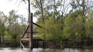 Hard to believe it could be that much higher.
I guess Joe was beginning to smell the barn too because he had an ambitious day planned for us. He was hoping to make it to an anchorage about 12 miles north of Mobile. We got a little help with current on the river, although not as much as we'd hoped, but the debris was not nearly as bad as the day before. As the sun was starting to set we entered Big Bayou Canot - about four miles short of Joe's goal, but more than 100 miles for the day. This anchorage was listed in two of our three books, so we entered tentatively.
Hard to believe it could be that much higher.
I guess Joe was beginning to smell the barn too because he had an ambitious day planned for us. He was hoping to make it to an anchorage about 12 miles north of Mobile. We got a little help with current on the river, although not as much as we'd hoped, but the debris was not nearly as bad as the day before. As the sun was starting to set we entered Big Bayou Canot - about four miles short of Joe's goal, but more than 100 miles for the day. This anchorage was listed in two of our three books, so we entered tentatively.  There were a few fish camps along the narrow channel. Joe actually had to go farther up than expected - off the chart! - to find water shallow enough to anchor in. Easy Pace had been ahead of us trying to make it to our original choice of anchorages, but had to turn around and join us. The railroad bridge between the two anchorages was having some problems and couldn't open for him. The anchorage turned out to be good - we held well in a fairly strong current that didn't reverse during the night as we'd feared.
 Along the way we passed the remains of the Rooster Bridge. You may have seen photos showing the tugboat Cahaba being pushed under the bridge in high water in 1979. It was completely submerged, but popped back up on the other side.
We ended up arriving at Bobby's Fish Camp around four and tied up. It had been a long hard day of dodging debris for Joe, which may be why Bobby's looked like a good stop. As it turned out, it was a marginal floating dock, tied to trees to hold it in place, with very small cleats to tie up to, no power and no protection from the wakes made by the tows during the night. Easy Pace, who had been with us for a few days, stopped at Bobby's also.
Along the way we passed the remains of the Rooster Bridge. You may have seen photos showing the tugboat Cahaba being pushed under the bridge in high water in 1979. It was completely submerged, but popped back up on the other side.
We ended up arriving at Bobby's Fish Camp around four and tied up. It had been a long hard day of dodging debris for Joe, which may be why Bobby's looked like a good stop. As it turned out, it was a marginal floating dock, tied to trees to hold it in place, with very small cleats to tie up to, no power and no protection from the wakes made by the tows during the night. Easy Pace, who had been with us for a few days, stopped at Bobby's also.  After the early morning phone call to the lock the next day, we left and were again locked through by about 7:00. This was Coffeeville Lock - our last lock of the trip! We checked the gauge on the way in and found that the river above the lock was now down to normal pool. We were expecting to go down about 34 feet, but after about ten feet the doors opened.
  The gauge exiting the lock showed the river was up about 24 feet above normal pool. Later we passed a post showing the record high water mark in April 1979.
  Hard to believe it could be that much higher.
I guess Joe was beginning to smell the barn too because he had an ambitious day planned for us. He was hoping to make it to an anchorage about 12 miles north of Mobile. We got a little help with current on the river, although not as much as we'd hoped, but the debris was not nearly as bad as the day before. As the sun was starting to set we entered Big Bayou Canot - about four miles short of Joe's goal, but more than 100 miles for the day. This anchorage was listed in two of our three books, so we entered tentatively.
Hard to believe it could be that much higher.
I guess Joe was beginning to smell the barn too because he had an ambitious day planned for us. He was hoping to make it to an anchorage about 12 miles north of Mobile. We got a little help with current on the river, although not as much as we'd hoped, but the debris was not nearly as bad as the day before. As the sun was starting to set we entered Big Bayou Canot - about four miles short of Joe's goal, but more than 100 miles for the day. This anchorage was listed in two of our three books, so we entered tentatively.  There were a few fish camps along the narrow channel. Joe actually had to go farther up than expected - off the chart! - to find water shallow enough to anchor in. Easy Pace had been ahead of us trying to make it to our original choice of anchorages, but had to turn around and join us. The railroad bridge between the two anchorages was having some problems and couldn't open for him. The anchorage turned out to be good - we held well in a fairly strong current that didn't reverse during the night as we'd feared.
  The next morning the generator decided not to start, so we got an early start in the chilly morning instead of warming the boat up first. Yes, chilly. Here we were, finally back in the real south and it was going down to 40 degrees at night! We arrived at the problematic railroad swing bridge and after a 45 minute wait squeezed through a narrow opening he gave us between trains.
  Soon we could see the Mobile skyline as we transited the busy port and on down Mobile Bay. Anxious to get home, we didn't stop even though we haven't visited Mobile. We'll save it for road trip since it's only about an hour from home.
  Back in salt water we should've been feeling like we were close to home, but 50 degrees just doesn't feel like Florida! As we cruised along, though we started seeing some signs. There were the multi-colored houses with white sand and palm trees.
 Then, jets from the nearby Navy base did a flyover to welcome us back. Of course we didn't a picture of the ones that flew right over our heads.
 Then the dolphins showed up to escort us to our last anchorage.
 Yes, we anchored one more time - only about 15 miles from home. We didn't want to try navigating our canal in the dark, and we weren't quite ready to end it all.
 November 19 we left our last anchorage near Ft. McRee and headed home. Soon we were intercepted by a USAF boat. Turns out they had swimmers in the water. Well, swimmers might not be the right term. We saw lots of black, floating bundles. We think those were the swimmers. (Later we saw an article in the newspaper about astronauts doing water survival training in the area.)
 Soon we came to the landmark white, square house at the entrance to our canal. The canal looked narrower than we remembered! Around noon, after almost 7000 miles and 172 locks, we tied Carolyn Ann up at the dock behind our house for a well deserved rest.
  Our good neighbor Greg, who makes sure nothing goes awry on the homefront, was there to greet us.
 All in all, it was a great trip; we saw so many interesting sights and landscapes, and met an incredible number of great people. We'll pause in Gulf Breeze for a while to make the rounds of the medical professionals and take care of some maintenance and upgrades on Carolyn Ann - also give her a good cleaning!
 Our good friends on Young America Fred and Linda came just after we arrived. They decided to leave YA at our dock for the Christmas Holidays while visiting their family in their NY home burrrr.
 That's all for our 2009 cruise and our loop.
Hope to see our friends and family on our cruise in 2010.
May everyone have a wonderful Christmas and a Happy Healthy New Year.
Love to all,
Joe, Punk and Rocky(the toothless dog)
If you'd like to see more pictures, follow the link to our picasa albums: http://picasaweb.google.com/joseph.pica
1 comment:
Welcome home. We have been waiting for your last installment. You did a great job, Punk. Hope to see you in the near future.
Barb and Randy
Post a Comment